Sketch Map - Adelaide, South Australia, 1913
The Map
| Full Title: |
Sketch Map - Adelaide, South Australia, 1913. |
| Other Title: |
Adelaide, South 154 M/IV Southern Half, South Australia. |
| Prepared by: |
Prepared by Commonwealth Section. Imperial General Staff. Commonwealth Department of Defence.
|
| Engraver: |
Photo-Lithographed at the Department of Lands and Survey, Melbourne, by W.J. Butson, 22.10.14. |
| Publisher: |
Published by Albert J. Mullett, Government Printer, Melbourne, June, 1915. |
| Publication Date: |
June 1915 |
| Size: |
94.5cm x 56.2cm (37¼" x 22") |
| Scale: |
1":1 mile, or, 1:63,360 Polyconic Projection. |
| Extent: |
Salisbury - McVitties Hill - Crafers - Gulf St. Vincent |
| Description: |
Photo-lithographed colour map, printed on paper, mounted on linen without dissection. Extreme wear at folds and corners with some loss.
This map was produced as part of the Commonwealth military survey of Australia (1914-1964), which commenced just prior to World War I.
The note on the map reads:
The framework of this sheet is based on the primary triangulation and hundreds plans of the Lands Dept. South Australia.
Levels obtained from Public Depts. of S.A. and extended by Aneroid.
Datum Low water, Tide Gauge Port Adelaide.
Contours determined by Aneroid & Clinometer.
Polyconic projection.
Surveyed 1913. Del 1914.
A Legend to the map is included below the bottom border.
|
Map Legend
| Bridge (wood, stone, or iron) |
 |
| Culvert |
 |
| Waterhole |
 |
| Swamp or Marsh |
 |
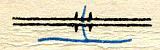
| Creek |
 |
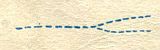
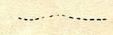
| Watercourse (non perennial) |
 |
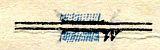
| Railway line |
 |
| Railway crossing |
 |
| Cutting |
 |
| Embankment |
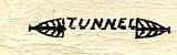
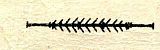 |
| Tunnel |
 |
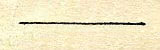
| Telegraph or Telephone line |
 |
| Telegraph Office |
 |
Road metalled
Road formed
Road unformed |
 |
| Track |
 |
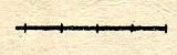
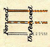
| Fence |
 |
|
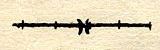
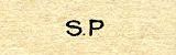
| Sign Post |
 |
| House |
 |
| School |
 |
| Post Office |
 |
| Hotel |
 |
| Blacksmith's Shop (forge) |
 |
| Church |
 |
| Mill or Factory |
 |
| Lighthouse |
 |
| Beacon |
 |
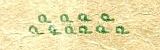
| Windmill |
 |
| Cemetery |
 |
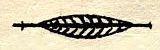
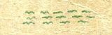
| Timber |
 |
| Scrub |
 |
| Cliff |
 |
| Altitude |
 |
| Trig Station |
 |
| Contours |
 |
|
How To Use These Map Pages
Use the thumbnail map at the top of each page to navigate your way around the map.
Hovering your mouse pointer over the thumbnails will highlight the individual sections, and display a pop-up message showing the places covered by that section of the map. Click the desired area to jump to a page displaying a full size image of that map section. You will need to scroll down the page a little to see the image of the map.
A coloured thumbnail image ('tile') on the thumbnail map at the top of the page will show you which section of the entire map you are currently viewing.
Click To Enlarge
Once you are viewing the desired map section, you can click on the map image to view an enlarged image of that section. Clicking on the map image allows you to switch back and forth ('toggle') between the normal sized image and the enlarged view of the section.
Place Name Search Feature
This map includes a search feature for place names and features. The search feature is located at the top right of each page, with a search box containing the words "Search This Map". The Search Engine enables a targeted search of the entire 1913 map of Adelaide.
To see how this works, you can search the 1913 map of Adelaide:
The Search Engine will also compiled a Complete Index Of Place Names, which is well worth referring to.
Please note that this is not a general search engine for the entire MAPCO website, but is targeted specifically at the map currently being viewed. The entire MAPCO site can be searched using the Google Search Engine on the Search Help page.
|


")
, Cross Keys Road, Windmill, Windmill, Main North Road, Parkfield, Goodall, Valley Farm, Hillside, Windmill, The Levels, Windmill, & Rosabell")


, Point Malcolm, Blairlogie, Mangroves, Adelaide - Port Adelaide - Semaphore - Largs & Outer Harbor Railway (Double Line), Estcourt House, Military Road, Heslop, Adelaide - Henley Beach Railway (Single Line), Seaton, The Grange, Jetty, Grange Road, Tockington Farm, Henley Beach, Jetty, & River Torrens")
, Ryde, Dry Creek, P????? Crossing, Cross Keys, Gepps Cross, Wireless Telegraph Station, Athol Farm, Northern Railway (Double Line), Connoll, Cheltenham Race Course, Adelaide - Port Adelaide - Semaphore - Largs & Outer Harbor Railway (Double Line), Woodville, Sewerage Farm, Islington, Railway Workshops, Enfield, Port Road, Subway, Glen Elder, Bowden, Prospect, Grange Road, Hindmarsh, River Torrens, & North Adelaide")


 Railway, Richmond, Adelaide - Melbourne Railway (Double Line), Keswick, Military Barracks, Marlborough Road, The Pines, Marion Road, Bay Road, Adelaide - Glenelg Railway (Double Line), Goodwood Station, Unley, River Sturt, Morphettville, Race Course, The Byre, Road to Marion, Tucker, Oaklands, Chaff Mills, Railway from Oaklands, Road to Marion, Willunga - Adelaide Railway (Single Line), South Road, Road to Reynella, Edwardstown, Windmill, Goodwood Road, Cross Road, Brownhill Creek, Mitcham Station, Blythwood Station, Clapham Station, & Road to Eden")
, Mitcham Station, Blythwood Station, Clapham Station, Mitcham, Tank, Quarry, Brown Hill, Brownhill Creek, Sanatorium, Road from Blackwood, Belair, Belair Station, Road to Mt. Lofty, Grieg, Road to Crafers, & Brook's Gully")


, Waterhole, Spoehr, Pennick, Braeside, Onkaparinga River, Von Howell, Woodside, Butter Factory, Eastern Branch (Onkaparinga River), Windmill, Esau, Mine Road, Ford, Jenkins, Size, Williams Hill, Fir Lea, Glen Artney, Ford, Windmill, Liberton, Ford, River View, Inverbrache, Drummond, Ford, Three Sisters, Windmill, Whitker, The Wheat Sheaf, Elderslie, Waterhole, River Hill, Waterhole, Bridge, Balhannah, Saw Mill, Balhannah, Road to Mt. Barker Jun, Brewery, Oakbank, Foot Bridge, Ford, Race Course, Brewery, Dahtober, Ruin, Glenthorn, Hill View, Ruin, Johnson Hill, Mitchell, Shaft, Glen Dew, Ruin, Ruin, & Road from Nairne")
, Bore, New Era, Ford, Graeber, Ruin, Ford, Sandy Waterholes, Rose Hill, Ford, Ruins, Teakle, Payne, Windmill, Esau, Mine Road, Reefton Heights, Donoghue, Wall, Basin Hill, Windmill, Harrogate Road, Key Hut, White House, Ford, Brushyards, Red Hill, The Wheat Sheaf, Elderslie, Dalmeen, Road from Nairne, Murdock's Hill, Peacock, Priess, Waterhole, Gum Glen, Scott's Creek, Ruins, Waterhole, Avery Hill, Foot Bridge, Ford, Waterhole, Ford, Cattle, Road from Nairne, & Road from Dawsley")


