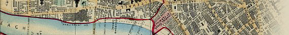
Other Maps, Views and Charts
There are currently 5 items from this category on display.
| FEATURED MAPCO MAP |
| ~ Ebb And Flow Of War : The Gallipoli Withdrawal ~ |

|
This map shows details of the ground won and held by the Australian and New Zealand ANZAC troops around Suvla Bay and Anzac Cove, and the British and French troops at Cape Helles, along with the numbers of casualties. Of particular interest is a comparison of the area covered by Hyde Park in London with the ground held by troops during the Gallipoli campaign.
Click the image below for a cropped view of the ANZAC area held by the Australian and New Zealand troops.

An explanation below the map of Gallipoli reads:
The shifting centre of gravity in the Near East from the Dardanelles to Salonika and the Suez Canal zone - due to the entry of Bulgaria into the war - necessitated the evacuation of Gallipoli, and this wonderful operation was executed without the loss of a single life. Thus ends a most glorious chapter in our military history, for though all the advantages of position on high entrenched ground lay with
the enemy, yet 100,000 men, with incomparable valour, maintained a magnificent offensive, and, in the words of Sir Ian Hamilton, "their progress was constant if painfully slow" in the restricted and exposed area held by us.
|
Upcoming Maps and Views
To aid students, historians, and genealogists tracing their ancestry, some of the following maps, views and charts will be selected for display in coming months:
- c1772 ~ A New And Accurate Map Of Europe. Divided Into Its Empires, Kingdoms, States And Republics, &c. Drawn By The Sieur Robert de Vaugondy, Geographer To The French King, And To The Duke Of Lorrain And Bar, Member Of The Royal Academy Of Sciences & Belles Letters At Nancy, With Many Additions & Improvements By Thos. Kitchin Geographer. London. (Printed For & Sold By Robt. Sayer, Map & Printseller At The Golden Buck Near Serjeants Inn, In Fleet Street. c1772)
- 1814 ~ Plan Routier de la Ville de Paris, Divisé en 12 Arrondissements ou Mairies et en 48 Quartiers. Sur luqel sont indique's tous les Changements & Projets ordonnes par le Gouvernement. Dédié et Présenté ŕ Mr. Le Comte Frochot, Conseiller d'Etat, Grand Officer de la Legion d'honneur &c: &c: Prefet du Departement de la Seine. 1812. Par Charles Picquet, nouvelle édition corrigée en 1814 (Paris, Charles Picquet, 1812-1814)
- 1830 ~ Carte Des Environs De Paris Par Bonhomme Graveur Géographe. 1830. (A Paris, chez AUVRAY Freres Quai Malaquais No. 11, et Quai Voltaire No. 5. 1830)
- c1830 ~ Newton's New Terrestrial Globe containing the latest Discoveries. (Pubd. By Newton & Son, 66 Chancery Lane. B.R. Davies, Del. & Sc.)
- 1834 ~ The Traveller's Guide Or Map Of The Roads, Canals & Rail Roads Of The United States, With The Distances From Place To Place, By H.S. Tanner. Cover Title: Tanner's American Traveller, Or Guide Through The United States. (1st Edition. Entered According To Act Of Congress In The Year 1834, By H.S. Tanner, In The Clerks Office Of The Eastern District Of Pennsylvania. Published By H.S. Tanner, 144 Chesnut St., Philadelphia. Henry Schenck Tanner, 1834.)
- c1837 ~ A Genealogical Chart of the Kings and Queens of England from the Reign of William the Conqueror to that of His Most Gracious Majesty William the Fourth (Second Edition - London. Published by George Taylor, Junr. Engraved by W.T. Fry. c1837)
- 1843 ~ Post Reise Karte von Deutschland mit spezieller Angabe der Eisenbahn - und Dampfschiffahrt - Verbindungen, unter der Leitung der Generaladministration der Königl. Bayer. Posten nach amtlichen Mittheilungen bearbeitet. Carte routi'ere et postale de l'Allemagne.
(Published by Verlag von Piloty & Loehle, Munich, 1843)
- 1854 ~ Collins' Illustrated Map Of Paris. Shewing All The Fortifications And Public Buildings; entitled 'Paris Illustré Et Ses Fortifications' (London: H.G. Collins, 22, Paternoster Row. Paris: F. Logerot. Quai Des Augustins. 1854)
- 1855 ~ Phelps's National Map Of The United States A Travellers Guide, Embracing The Principal Rail Roads, Canals, Steam Boat & Stage Routes, Throughout The Union. Taken From: Phelps' Travelers' Guide Through the United States; Containing Upward Of Seven Hundred And Fifty Railroad, Canal, Stage, And Steamboat Routes: Accompanied With A New Map Of The United States. New And Improved Edition. (New York. Published By Ensign, Bridgman & Fanning, 156 William St. 1855.)
- 1890 ~ Rand, McNally & Co.'s New Railroad, County And Township Map Of New York, Showing Every Railroad Station And Post Office In The State. Scale: 11.4 Miles : 1 Inch approx. (1890. Rand, McNally & Co., Map Publishers And Engravers, 148 To 154 Monroe Street, Chicago.)
- c1900 ~ Historical Map Of Egypt And The Countries Connected With It. (c1900. Stanford's Geographical Establishment, London.)
|