MAPCO Terms Of Use
About MAPCO
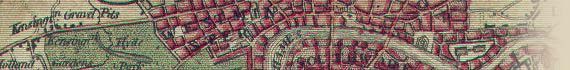
The MAPCO website is a philanthropical project, designed to raise awareness and appreciation of history using old maps and photographs. The website displays many high quality historical maps and views, with an emphasis on London, U.K., and Australia. The MAPCO website is a free access site, and will remain so.
This site is intended primarily as a research aid for genealogical and historical researchers. The maps, prints and views on the MAPCO website are displayed free of charge for the use of students, historians and genealogists, to assist with heritage and family history research.
The site is regularly reviewed in the U.K. press and historical/family history magazines, and the National Library of Australia has recognised the website as a digital resource of cultural significance, and now archive the site annually for posterity.
The images on the MAPCO website, and the site pages and design, are and remain © Copyright David Hale / MAPCO 2006-2013.
All images displayed on the MAPCO website are a MAPCO representation of the original map or print, and are not the original map or print itself. The scanned digital images displayed on this site were produced by MAPCO, and are covered by copyright. All of the digital repairs, enhancements, cropping, dissection, enlargement, and method of display of images which make the MAPCO website look so good are solely due to work carried out by MAPCO. The maps and prints displayed are a product of extensive work carried out by MAPCO, and are not representative of the original display design, state, condition, size, sharpness or quality of the original maps or prints, which have often suffered much over the centuries. MAPCO has spent considerable time designing the site and preparing these images for free display.
Terms Of Use
Terms for private and commercial use of MAPCO images are as follows:
- Permission for use must be sought from MAPCO before using any images on this site. Contact MAPCO through the 'Contact' link above.
- For a minimal 'copyright release' fee, images on the MAPCO website can be used for illustration purposes in local history publications, family history publications, student projects, etc.
- Commercial (business) use of these images is not allowed without payment of a full 'copyright release' publication fee.
- For recognised registered charitable organizations, profitable or income earning use of these images may be allowed for a minimal fee, or possibly without payment of a 'copyright release' publication fee, by agreement with MAPCO. Permission for use must be requested through the 'Contact'
link above.
- All use of MAPCO map and view images must acknowledge David Hale and the MAPCO : Map And Plan Collection Online website at http://mapco.net as the source.
Enjoy these beautiful maps and views!
David Hale / MAPCO

MAPCO Maps In Publications And Documentaries
| Date |
Company |
Publication |
MAPCO Map Used |
| April 2006 |
VICTOR bureau,
France.
victorbureau.com |
London Secret Notebook
Television documentary series.
50 short documentaries on secret, unusual and little known spots in London.
|
Cross's New Plan Of London 1850 |
| Aug 2006 |
National Geographic Television,
U.S.A.
channel.nationalgeographic.com |
Is It Real? Jack the Ripper
National Geographic Channel documentary.
Single documentary that premiered on Monday, October 30, 2006, on the National Geographic Channel in the United States.
View Credits.
|
Cross's New Plan Of London 1850 |
| June 2006 |
make Ltd,
55-65 Whitfield Street,
London W1T 4HE,
U.K.
www.makearchitects.com |
Maps of London from 1767 and 1795 showing the Tottenham Court Road, Goodge Street and Warren Street areas used in a potential project presentation. |
A Plan Of The Cities Of London And Westminster, And Borough Of Southwark, With The New Buildings 1767.
Cary's New And Accurate Plan Of London And Westminster 1795.
|
| July 2006 |
Ancestors
U.K.
|
July 2006 issue of Ancestors magazine including a short review of the MAPCO website in the 'Internet News' section. |
Lewis's Map Of England And Wales c1840
|
| Mar 2007 |
State Library of South Australia.
www.slsa.sa.gov.au
National Library of Australia.
pandora.nla.gov.au |
The State Library of South Australia in partnership with the National Library of Australia identified the MAPCO website as a site of national significance and lasting cultural value, and archived the MAPCO website onto the National Library's PANDORA Archive (Preserving and Accessing Networked Documentary Resources of Australia).
The National Library of Australia aims to build a comprehensive collection of Australian publications to ensure that Australians have access to their documentary heritage now and in the future. The National Library and Australian State Libraries have traditionally collected items in print, but are also committed to preserving electronic publications of lasting cultural value. |
Entire MAPCO website archived annually |
| May 2007 |
Your Family Tree
U.K.
|
May 2007 issue of Your Family Tree magazine featured a 4-page illustrated article about the MAPCO website. |
Cross's New Plan Of London 1850 |
| Sept 2007 |
Practical Family History
U.K.
|
September 2007 issue of Practical Family History magazine featured a double-page spread of ‘Web News’ including a short review of the MAPCO website. |
Cross's New Plan Of London 1850 |
| Nov 2007 |
Black Dog Publishing London UK
10A Acton Street,
London WC1X 9NG,
U.K.
www.blackdogonline.com |
Mapping London: Making Making Sense of The City
by Simon Foxell
A beautiful, compelling anthology of over six centuries of London maps, tracing the mesmerising evolution of the city and exploring the hopes and fears of its inhabitants as history unfolds.
21 MAPCO maps of London were used in this publication.
|
Various maps of London, including preview items |
| Nov 2008 |
Family History
U.K.
|
November 2008 issue of Family History magazine featured an article about maps which included a mention of the MAPCO website. |
|
| Mar 2009 |
Time Team / Videotext Communications
U.K.
|
Time Team - Series 16
Programme 10. Called to the Bar (8 March 2009)
Location: Lincoln's Inn, London
Period: Anglo-Saxon, Medieval
Called to the Bar
The Team visits Lincoln's Inn, London where they have been asked to investigate the remains of a 13th-century palace that belonged to Henry III's Lord Chancellor.
|
Cary's New And Accurate Plan Of London And Westminster 1795. |
| Mar 2009 |
Stylorouge
Creative Consultants
57/60 Charlotte Road, London EC2A 3QT
U.K.
www.stylorouge.com
|
Catalogue reissue of Maladjusted CD by Morrissey |
Whitbread's Map Of London Extending Four Miles Round Charing-Cross 1865. |
| May 2009 |
aia London
5 St John's Lane
London EC1M 4BH
U.K.
www.aia.co.uk |
Used for an interior design display panel for the London Metropolitan Police Heritage Centre. |
Smith's New Map Of London c1828 |
| Jun 2009 |
Becket Collection
Royal Academy of Music
London Marylebone Road
London NW1 5HT
U.K.
www.ram.ac.uk |
Artwork for a small print run scholarly musical instrument catalogue 'The British Violin' by David Rattray of the Royal Academy of Music, London. |
Cary's New And Accurate Plan Of London And Westminster 1795 |
| Aug 2009 |
"Murdoch Mysteries"
Shaftesbury Murdoch III Inc.
249 Evans Ave.,
Etobicoke, ON M8Z V52
Canada
www.murdochmysteries.com |
Used in The Murdoch Mysteries episode 301 "The Murdoch Identity". |
Lavars's New & Improved Map Of Bristol & Clifton c1863 |
| Sep 2009 |
Carnegie Publishing
Carnegie House
Chatsworth Road
Lancaster LA1 4SL
U.K.
www.carnegiepublishing.com
|
Use in 'London. A History' by Professor Jeremy Black.
Visit the website at www.london-historybook.co.uk
|
Parts of the Strand and Covent Garden, as they appeared in the reign of Queen Elizabeth, 1578.
A Plan Of The City And Environs Of London As Fortified By Order Of Parliament In The Years 1642 & 1643.
|
| |
|
|
|
| |
|
|
|
| |
|
|
|
| |
|
|
|
|