MAPCO
MAPCO
MAPCO : Map And Plan Collection Online MAPCO
MAPCO Store
MAPCO


A Plan Of The City And Environs Of London As Fortified By Order Of Parliament In The Years 1642 & 1643.


Click For An Enlarged Image

~ Click For An Enlarged Image ~


The Map

Full Title:
A Plan Of The City And Environs Of London As Fortified By Order Of Parliament In The Years 1642 & 1643.
Map Maker:
Walter Harrison
Date:
1666
Source:
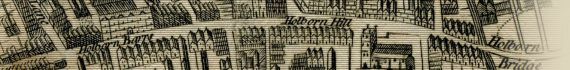
Engraved for "A New and Universal History, Description, and Survey Of The Cities Of London and Westminster, The Borough of Southwark, And Their Adjacent Parts. Including not only all the Parishes within the Bills of Mortality, but the Towns, Villages, Palaces, Seats, and Country, to the extent of Twenty Miles round, Comprizing A Circle Of Near One Hundred And Fifty Miles" By Walter Harrison, Esq. 1775.
Publisher:
London. Published for Harrison's History of London. 1775.
Printed for J. Cooke, at Shakespeare's Head, Pater-Noster-Row. 1775.
Plate Size:
31.5cm x 20.9cm (12½" x 8¼" Approx)
Extent:
Shoreditch - Stepney - Vauxhall - Constitution Hill
Notes:
Includes "An Explanation of the several Forts on the Line of Communication", which details all 23 forts on the London wall.


How To Use These Map Pages


Enlarged View:

Click on the map image at the top of this page to view an enlarged image of this map. The enlarged image will display on a new web page.

To navigate back to the main map page (this page), click on the enlarged map image or the map title displayed at the top of the page.


Date


This site has been accessed Counter times.


Copyright Date