|
War Map Of The Gallipoli Peninsula 1915
* Click Here For A Large View Of This Map *
** View More MAPCO Maps Of Gallipoli **
The Map
| Map Title: |
The Daily Telegraph War Map No. 12. |
|
| Cover Title: |
The Daily Telegraph War Map Of The Gallipoli Peninsula (No. 12.) |
| Mapmaker: |
Alexander Gross, F.R.G.S. |
| Publisher: |
Geographia Ltd., 55, Fleet Street, London, E.C. |
| Date: |
1915 |
| Size: |
89cm x 56.5cm (35" x 22¼") |
| Scale: |
¾ Inch : 1 Mile |
| Extent: |
Bulair - Chardak - Yeni Keui - C. Tekeh |
| Description: |
Folding World War I map of Gallipoli. On paper, in excellent condition.
Alexander Gross also published other Daily Telegraph War Maps, as well as a Map of England and Wales in 19 sheets.
The front cover label of the Gallipoli map reads:
The Daily Telegraph
War Map Of The Gallipoli Peninsula
(No. 12.)
On A Very Large Scale Of About ¾ Inch To 1 Mile.
By Alexander Gross, F.R.G.S.
Contains More Information Than
Any Existing Map Of The Same Area.
|
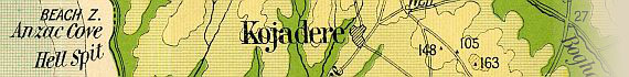
The areas of greatest interest to ANZAC researchers fall on the dissections of this Gallipoli map, so these areas have been displayed separately below for ease of reference.
Click the images below for enlarged views of Anzac Cove, Suvla Bay, and the Gallipoli Peninsula.
Image Sizes and Download Times
The images of the map of Gallipoli displayed here are scans of each folded section of the map. The images have an average size of approximately 273KB. At 56KB dial-up connection speed each page will take about 40 seconds to fully load, although some pages can take up to approximately 70 seconds to load.
Please be patient while the pages load.
|


")
 & Yeni Keui")


 & The Narrows")


, & The Narrows")


