|
Plan Of The Borough Of Hornsey
1925
The Map
| Full Title: |
Plan Of The Borough Of Hornsey |
| Mapmaker: |
E.J. Lovegrove, M. Inst. C.E., Engineer & Surveyor, Town Hall, Highgate, N.6. |
| Publisher: |
Unknown |
| Date Of Map: |
July 1925 |
| Size: |
69.3cm x 56.5cm (27¼" x 22¼") |
| Scale: |
7¼" : 1 Mile |
| Extent: |
Friern Barnet Road - Finsbury Park - Seven Sisters Road - Bishops Avenue |
| Description: |
Folding map of the Borough of Hornsey, laid down on linen. 24 folding sections with marbled end boards. Original slipcase not present. |
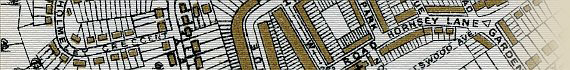
This map by E.J. Lovegrove affords a fascinating glimpse of the Borough of Hornsey between the wars.
The map records many places within the borough, including the Isolation Hospital, Coldfall Wood, Allotments, Alexandra Palace and Alexandra Park, Race Course, Filter Beds, Duckett's Green, Western Highways Depot & Museum, Highgate Wood, Manor Farm, Northfield Hall, London & North Eastern Railway, Queen's Wood, Pleasure Grounds, Finsbury Park, and much more.
You can view the map note and imprint by clicking on the images below:
Image Sizes and Download Times
The images of the map of Hornsey displayed here are scans of each section of the map divided into quarters for speed of loading, and have an average combined size of approximately 400KB. At 56KB dial-up connection speed each page will take about 30 seconds to fully load, although some pages can take up to approximately 70 seconds to load.
This map also includes further clickable enlarged views of the quartered map images. These are accessed by clicking the 4 quarters of each map image (top left, top right, bottom left, and bottom right quarters). The enlarged images vary in size from 170KB to 590KB, taking between 20 seconds and 80 seconds to load at a 56KB connection speed.
Please be patient while the larger pages load, as it is well worth the wait.
|