|
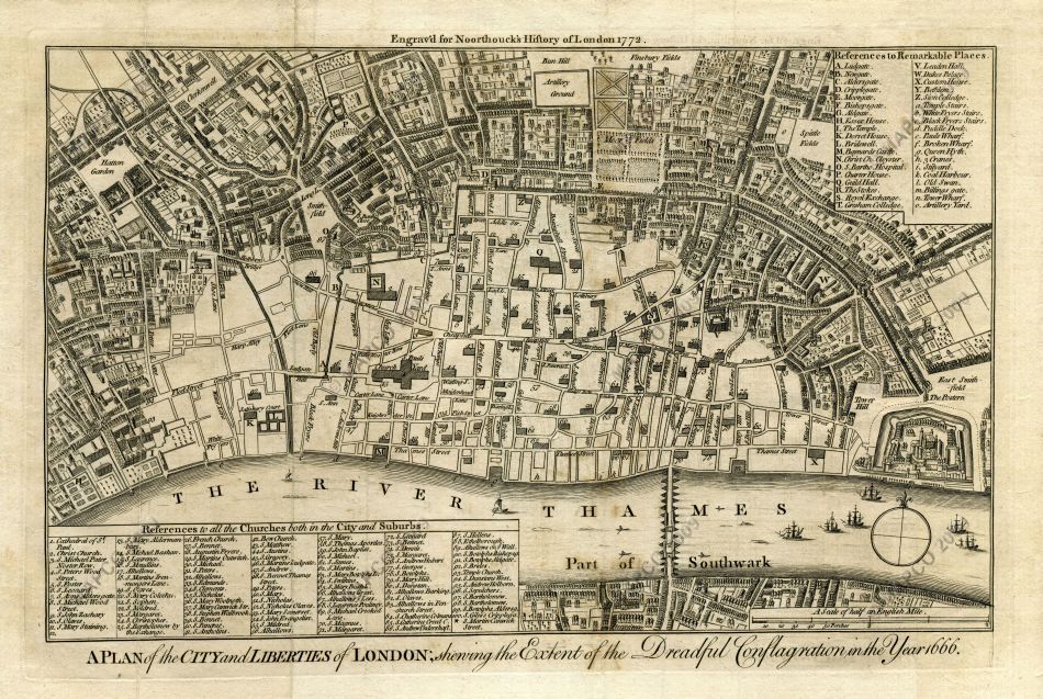
A Plan of the City and Liberties of London,
Shewing the Extent of the Dreadful Conflagration in the Year 1666

~ Click For An Enlarged Image ~
The Map
| Full Title: |
A Plan of the City and Liberties of London, Shewing the Extent of the Dreadful Conflagration in the Year 1666
|
|
| Map Maker: |
John Noorthouck |
| Date: |
1772 |
| Source: |
Taken from "A New History of London, Including Westminster and Southwark, to which is added, A General Survey of the Whole; Describing The Public Buildings, Late Improvements, &c. Illustrated WIth Copper-Plates." by John Noorthouck. London, 1773. |
| Publisher: |
Printed for R. Baldwin, 47, Pater-Noster Row. 1773. |
| Size: |
20cm x 32.7cm (8" x 13" Approx) |
| Scale: |
6¾" : 1 Statute Mile (Approx) |
| Extent: |
Bun Hill - East Smith Field - Southwark - Grays Inn Lane |
| Description: |
Folding map showing the extent of the Great Fire of London, engraved for Noorthouck's History of London 1772. Includes a Reference To All The Churches Both In The City And Suburbs, and a Reference To Remarkable Places.
Based on Wenceslaus Hollar's 1666 map of the Great Fire of London entitled A Map or Groundplot of the City of London and the Suburbes thereof, that is to say, all which is within the Jurisdiction of the Lord Mayor or properlie calld't London by which is exactly demonstrated the present condition thereof, since the last sad accident of fire. The blank space signifeing the burnt part & where the
houses are exprest, those places yet standing.
As described by the lengthy title above, the blank part of the map clearly shows the extent of the Great Fire.
This map is represented in Howgego as No. 19, Derivative (b).
|
|
|
How To Use These Map Pages
Enlarged View:
Click on the map image at the top of this page to view an enlarged image of this map. The enlarged image will display on a new web page.
To navigate back to the main map page (this page), click on the enlarged map image or the map title displayed at the top of the page.
Supersized View:
Click on the small thumbnail map image above to view a very large, highly detailed image of this map. The image file size is quite large, being 6.7Mb, and measuring 6200 pixels wide x 4158 pixels high. This highly detailed image will display on a new web page.
To navigate back to the main map page (this page), click on the enlarged map image or the map title displayed at the top of the page.
|


