|
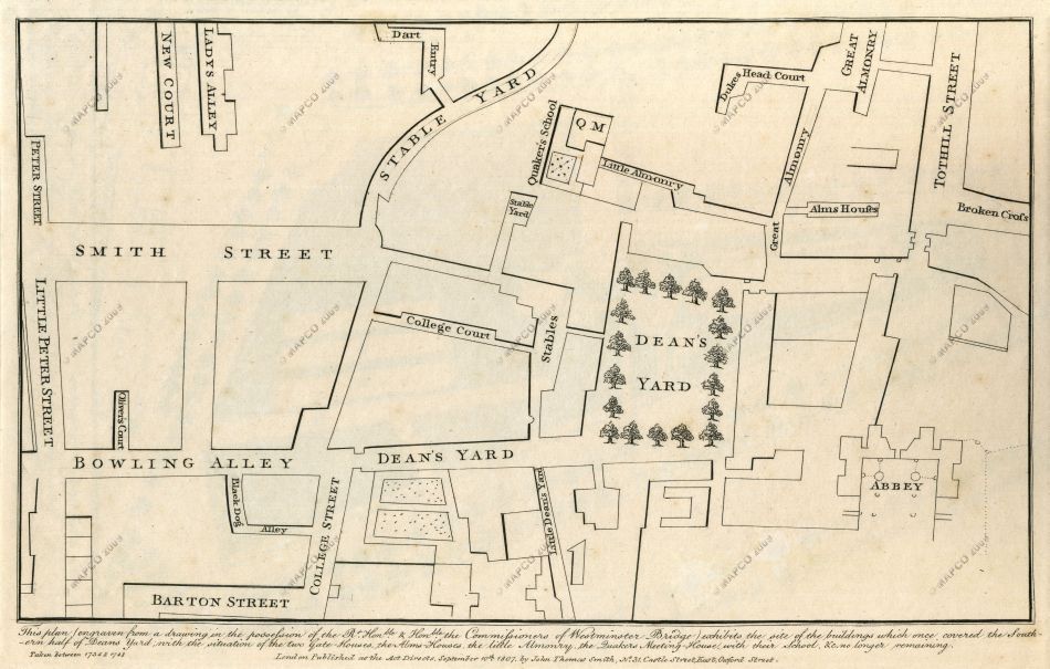
Site Of The Buildings Which Once Covered The Southern Half Of Deans Yard, 1734-1748.

~ Click For An Enlarged Image ~
The Map
| Full Title: |
Site Of The Buildings Which Once Covered The Southern Half Of Deans Yard. |
| Map Maker: |
John Thomas Smith |
| Date: |
1734-1748 |
| Source: |
Taken from "Antiquities Of The City Of Westminster" by John Thomas Smith, 1807; containing "Sixty-Two Additional Plates To Smiths Antiquities Of Westminster" by John Thomas Smith, c1809. |
| Publisher: |
London. Published as the Act directs, September 10th, 1807, by John Thomas Smith, No. 31, Castle Street East, Oxford Street. |
| Plate Size: |
26.5cm x 16.9cm (10½" x 6½" Approx) |
| Extent: |
Dart Entry - Broken Cross - Barton Street - Peter Street |
| Notes: |
The caption below the map reads: |
This plan (engraved from a drawing in the possession of the Rt. Honble & Honble the Commissioners for Westminster Bridge) exhibits the site of the buildings which once covered the Southern half of Deans Yard; with the situation of the two Gate-Houses, the Alms Houses, the little Almonry, the Quakers Meeting-House, with their School, &c., no longer remaining. |
|
Taken between 1734 & 1748 |
London. Published as the Act directs, September 10th, 1807,
by John Thomas Smith, No. 31, Castle Street East, Oxford Street. |
How To Use These Map Pages
Enlarged View:
Click on the map image at the top of this page to view an enlarged image of this map. The enlarged image will display on a new web page.
To navigate back to the main map page (this page), click on the enlarged map image or the map title displayed at the top of the page.
|


