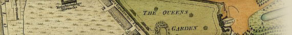
Wallis's Plan Of The Cities Of London And Westminster 1801
The Map
| Full Title: |
Wallis's Plan of the Cities of London and Westminster
1801 |
|
| Publisher: |
John Wallis, No.16 Ludgate Street |
| Date: |
January 24th 1801 |
| Size: |
89cm x 45cm (35" x 17¾") |
| Scale: |
6¼" : 1 statute mile |
| Extent: |
Pentonville - Stepney - Lambeth - Hyde Park |
| Description: |
Folding map. Slipcase in poor condition, though label
is better preserved. Hand coloured sections laid down on linen. Title on oval
at top left. Explanation of symbols, Hackney-Coach Fares and Scale at bottom right.
This map is extended East by an extra sheet 17¾" x 8¼", from Rotherhithe
to Stepney. |
An unrecorded variant of Howgego No. 214
(4), this copy does not include the additional title "The Isle Of Dogs and
the New Docks for the West India Trade" in an oval at the top left as cited
in Howgego, nor the imprint "Published
May 18th 1801 by J. Wallis".
How To Use These Map Pages
Use the thumbnail map at the top of each page to navigate your way around the map.
Hovering your mouse pointer over the thumbnails will highlight the individual sections, and display a pop-up message showing the area covered by that section of the map. Click the desired area to jump to a page displaying a full size image of the map section. You will need to scroll down the page a little to see the image of the map.
A coloured thumbnail image on the thumbnail map at the top of the page will show you which section of the entire map you are currently viewing.
Click To Enlarge
Once you are viewing the desired map section, you can click on the map image to view an enlarged image of that section.
Clicking on the map images allows you to switch back and forth ('toggle') between the normal sized image and the enlarged view of the section.
|