A New Topographical Map Of The Country In The Vicinity Of London, Describing All The New Improvements, Metropolitan Boroughs And Parish Boundaries c1872
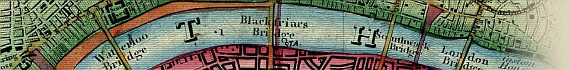
~ Click Here To View A Large Thumbnail Map Image ~
The Map
| Full Title: |
A New Topographical Map Of The Country In The Vicinity Of London, Describing All The New Improvements, Metropolitan Boroughs And Parish Boundaries. |
|
| Slipcase Title: |
London & Envs. James Wyld, Geographer To Her Majesty. 457 Strand. Charing Cross. (East.) 2 Doors Down From Trafalgar Square. Maps, Charts, Globes, & Geographical Works Of Every Description.
|
| Publisher: |
Published By James Wyld, Successor To Mr. Faden, Geographer To Her Majesty, Charing Cross East.
|
| Date: |
The slipcase label includes a handwritten date of 1872. |
| Size: |
75cm x 77.5cm (29½" x 30½") |
| Scale: |
2": 1 Statute Mile |
| Extent: |
Edmonton - Plumstead - Croydon - Chiswick |
| Description: |
Title imprint in border above map. The margin is divided into miles N, S, E, & W of the meridian and parallel of St. Paul's, County boundaries, roads, etc., are coloured. No key or hatching symbols.
(Source: Howgego No. 250)
A later variant of Howgego No. 250. Dated at c1872, but actual date to be determined.
A note in the bottom margin reads:
NB. The Circle round London denotes the extent of the Four Mile Radius, and beyond which Hackney Carriages charge Back Fares. |
How To Use These Map Pages
Use the thumbnail map at the top of each page to navigate your way around the map. Hovering your mouse pointer over the thumbnails will highlight the individual sections, and display a pop-up message showing the northern and southern extent of the map sections.
Click the desired area to jump to a page displaying a full size image of that map section. You will need to scroll down the page a little to see the image of the map. A coloured thumbnail image on the thumbnail map at the top of the page will show you which section of the entire map you are currently viewing.
Click To Enlarge
Once you are viewing the desired map section, you can click on the map image to view an enlarged image of that section. Clicking on the map image allows you to switch back and forth between the normal sized image and the enlarged view of the section.
|