MAPCO
MAPCO
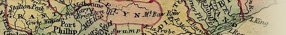
Wyld's Map of Australia c1863 MAPCO
MAPCO Store
MAPCO


Back To Map Index
Back To Map Index
Map Title & Indian Ocean Map Title & Dampiers Archipelago Cape Talbot, Sturts Creek, & Mount Wilson, New Holland Port Essington & Alexandra Land; Showing The Routes Of Stuart's Expeditions Of 1860, 1861, & 1862 Torres Strait, Cape York, Gulf Of Carpenteria, Burkes Land, & Queensland, New South Wales; Showing The Route Of Burke & Wills Expedition Of 1861, & Landsborough's Expeditions Of 1861 & 1862 Torres Strait, The Great Barrier Reef, & Repulse Bay, Queensland, New South Wales Bonvouloirs, & Vine's Horse-shoe Shoal, South Pacific Ocean San Christoval, Two Islands With Trees, & Minerva Shoal, South Pacific Ocean
Indian Ocean, North West Cape Or Vlaming Head, Freycinet's Harbour, & Port Gladstone, New Holland Cape Preston, Hammersley Range, Port Gladstone, Swan River, Fremantle, & Perth, New Holland Sandy Country, Sandy Hills Sprinkled With Vegetation, & Port Dover, New Holland Crawford Range, Mount Strzelecki, Mount Freeling, & Chamber Pillar, Stuarts Land; & Stuart Range & Lake Gairdner, South Australia McKinlay's Range, Burkes Land, & Port Augusta, South Australia; Showing The Routes Of Mitchell's Expedition Of 1836, Burke's Expedition Of 1860, McKinlay's Expedition Of 1862, & Landsborough's Expedition Of 1862 Mount McConnell, Queensland, To Liverpool Ranges, New South Wales; Showing The Routes Of Sturt & Hume's Expedition Of 1829, Sturt's Extent In 1829, Major Mitchell's Expedition Of 1832, & Landsborough's Expedition Of 1862; With A Note 'Here Mr. Cunningham Was Killed' Keppel Bay, Hervey's Bay, Moreton Bay, & Brisbane, Queensland; & Port Macquarie, & Sugar-loaf Point, New South Wales Bellona's Shoal To Lord Howes Island, South Pacific Ocean
Indian Ocean; & Cape Naturaliste, Cape Mentelle, Cape Freycinet, & Cape Leeuwin, New Holland Port Leschenault, Flinders Bay, King George's Sound, Albany, & Esperance Bay, New Holland Cape le Grand, Cape Arid, & Port Culver, New Holland; & Map Of The World Showing British Possessions Nuyt's Archipelago, Flinders Island, Coffins Bay, Neptune Island, Sleaford Bay, & Port Lincoln, South Australia; & Map Of The World Showing British Possessions Spencers Gulf, Yorke's Peninsula, Gulf Of St. Vincent, Kangaroo Island, Adelaide, & Mount Gambier, South Australia; Swan Hill, Portland, Belfast, Port Fairy, & Warnambool, Australia Felix, Victoria Bathurst To Eden, New South Wales; Geelong, Port Philip, Melbourne, & Wilson's Promontory, Australia Felix, Victoria; Bass Strait, & Van Diemens Land Port Stephens, Port Hunter, Port Jackson, Sydney, Parramatta, Botany Bay, & Wollongong, New South Wales; & Hunter Islands To South West Cape, Van Diemens Land Cape Barren Island, Launceston, Port Arthur, Tasmans Peninsula, Derwent Riiver, & Hobart Town, Van Diemens Land


This Image © Copyright MAPCO 2007
Click The Image For Enlarged Views
Click To Enlarge Top Left Quarter Click To Enlarge Top Right Quarter
Click To Enlarge Bottom Left Quarter Click To Enlarge Bottom Right Quarter


Date


This site has been accessed Counter times.


Copyright Date